
New UltraMap reconstruction pipeline for DSM, DTM, orthomosaic, and 3D TIN production
15 September 2026
Last updated on 22 Sep 2026

Whether the final deliverable is a point cloud, DSM, DTM, orthomosaic, or 3D TIN, product quality depends on the quality of the underlying geometric reconstruction. Every downstream mapping product is built on this geometric foundation.
To strengthen that foundation, we developed a new reconstruction approach for UltraMap, coming in 2027. The technology improves reconstruction quality and robustness, resulting in cleaner DSMs, more reliable DTMs, more precise orthomosaics, and more consistent 3D products.
In this blog post, we look at why geometric reconstruction matters, how the new approach improves robustness under challenging imaging conditions, and what benefits users can expect for DSM, DTM, orthomosaic, and 3D product generation.
Photogrammetric reconstruction is the process of deriving the three-dimensional shape of the Earth's surface from overlapping aerial imagery. It serves as the basis for nearly every mapping product generated in a production workflow.
Any limitations in the reconstruction stage propagate directly into downstream products. Surface inconsistencies can affect DSM quality, terrain extraction becomes more difficult when the surface model contains artifacts, orthorectification depends on accurate elevation information, and 3D products inherit the geometric characteristics of the underlying reconstruction.
For that reason, improvements in reconstruction quality benefit the entire production chain. A stronger geometric foundation improves the quality and consistency of DSM, DTM, orthomosaic, and 3D deliverables while also supporting more efficient production workflows.

MORE ROBUST PRODUCTION WORKFLOWS
Greater stability in difficult image geometry improves reliability across challenging projects

LESS MANUAL POST-PROCESSING
Cleaner reconstruction results reduce manual editing efforts in all downstream products

EASIER QUALITY CONTROL
Fewer artifacts and mismatches make outputs faster to review and validate.

BETTER CONSISTENCY ACROSS DELIVERABLES
More aligned elevation products, orthomosaics, and 3D outputs from one geometric basis
A new ML-based approach to photogrammetric reconstruction
The new UltraMap reconstruction pipeline introduces a fundamentally updated approach to generating dense 3D surface information from aerial imagery.
A key advantage of the new approach that leverages state-of-the-art machine learning advancements is its robustness in conditions where traditional stereo reconstruction becomes less reliable. Conventional methods depend heavily on favorable image geometry, strong local texture, and sufficient image intersection angles. When these conditions are less than ideal, surface reconstruction can become more challenging.
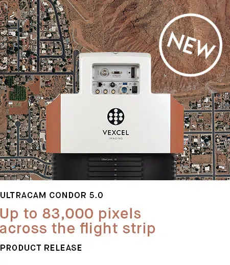
This is particularly relevant for modern large-format wide area mapping systems such as the UltraCam Condor 5.0. Its highly efficient rectangular footprint enables very productive image acquisition over large areas. However, compared to more square image footprints, overlapping Condor images are often viewed from narrower angles, providing less geometric depth information for traditional stereo matching.
The new reconstruction pipeline is specifically designed to handle such geometries more robustly. As a result, customers can confidently generate high-quality DSMs, DTMs, orthomosaics, and 3D products from Condor imagery while fully benefiting from the camera's exceptional collection efficiency.
Nadir and oblique imagery from the Dragon 4.2 were processed fully automatically with the new reconstruction approach, demonstrating robust surface reconstruction even in the narrow alleyway.


DSM and DSMOrtho of the same dataset over a larger area:


UltraCam Dragon 4.2 (image data only, no LiDAR) | 5 cm GSD | Graz, Austria

Sharper and cleaner Digital Surface Models (DSMs)
The most direct impact of the new reconstruction pipeline can be seen in Digital Surface Models. The result of the new reconstruction is a cleaner, more complete, and more reliable DSM:
- Sharper building outlines and roof structures
- Flatter roof surfaces with less noise
- Better separation between trees and buildings
- More realistic vegetation shape and height variation
- Fewer artifacts on roads, parking lots, and open ground
- More complete reconstruction in shadows and low-texture areas
- Better representation of bridges, overpasses, and fine structures
Click the magnifying glasses to reveal the underlying DSM:


UltraCam Dragon 4.2 | 5 cm GSD | Graz, Austria
More reliable Digital Terrain Models (DTMs)
Digital Terrain Models rely on accurate separation of terrain and above-ground objects. The quality of the initial surface reconstruction therefore plays a critical role in terrain extraction.
By providing a cleaner and more consistent representation of the surface, the new reconstruction pipeline supports more reliable DTM generation, particularly in complex environments such as bridges, embankments, highway interchanges, elevated road networks, and urban transition zones. The improved geometric foundation helps preserve terrain continuity and contributes to more accurate elevation models for mapping, engineering, and analysis applications.


UltraCam Merlin 5.0 f120 | 5 cm GSD | Gleisdorf, Austria
Learn how to create a globally consistent DTM in UltraMap at the push of a button – perfectly aligned and ready for quality check and integration in geospatial workflows:
Terrain modeling in UltraMap
Higher-quality orthomosaics
Orthomosaic quality depends not only on imagery but also on the accuracy of the underlying elevation information used during orthorectification.
With the new reconstruction in UltraMap, orthomosaic generation benefits from:
- Crisper building outlines and better corner definition
- Better separation between trees and buildings
- Reduced ghosting and motion-related artifacts
- Straighter road markings and cleaner painted features
- Cleaner bridge decks and better handling of multiple elevation levels
- Reduced seamline visibility and better alignment between neighboring images
The result is an orthomosaic that is both visually cleaner and more geometrically faithful to the scene.


UltraCam Merlin 5.0 f120 | 15 cm GSD | Graz, Austria
More consistent 3D models
The benefits of improved reconstruction extend directly into 3D product generation. Built on the same reconstruction basis, the benefits for 3D workflows include:
- New support for water handling
- Sharper building structures
- Improved terrain representation
- Better bridge modeling
- Fewer geometric artifacts
Both the DSM and 3D reconstruction workflows leverage a common reconstruction framework, enabling shared advances in surface modeling, robustness, and geometric quality across both product lines.


3D Tins processed in UltraMap, captured from the UltraCam Dragon 4.2 f50 at 5 cm GSD over Graz, Austria.
Every professional mapping workflow depends on reliable geometry. Our new ML-based reconstruction establishes a stronger geometric foundation for the full UltraMap production chain, improving the quality, consistency, and production efficiency of every downstream deliverable.
Coming to UltraMap in 2027, the new reconstruction pipeline marks the next step in building better mapping products from better geometry.
See how UltraMap empowers most efficient mapping workflows.
Learn more


