Tuck Mapping adds capacity with an UltraCam Falcon Mark 2
Graz, Austria • 16 February 2023
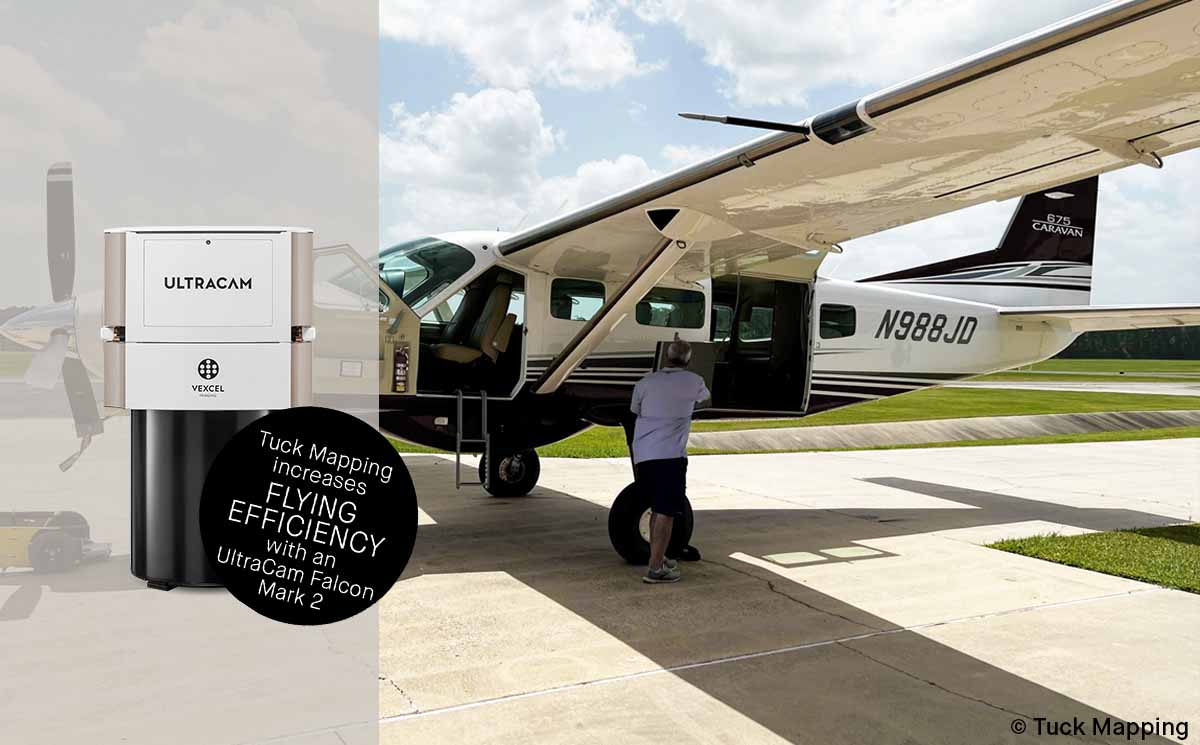
Tuck Mapping is taking delivery of a second UltraCam Falcon Mark 2 large format aerial camera in mid-February 2023. Since purchasing the sensor from Vexcel Imaging last summer, the Virginia-based surveying and mapping company also invested in a new Cessna Caravan, a turboprop known for its rugged utility and flexibility and adapted to carry the UltraCam and a LiDAR sensor side by side.
Featuring an image footprint of 17,310 x 11,310 pixels and a capture rate of 1.35 seconds per frame, the UltraCam Falcon Mark 2 is the perfect aerial camera for capturing large areas in a short time, even at lower altitudes, shortening the hours needed for collection and optimizing flying windows. Simultaneous collection of LiDAR and imagery at fast speeds improves efficiency and reduces costs.
“We’re experiencing growing demand from other small businesses that want us to provide high-density LiDAR and high-resolution imagery, so doubling our capacity with a second Falcon Mark 2 made sense,” said Robert “Bobby” Tuck, president of Tuck Mapping. “The large footprint and excellent image quality over large areas gives us a competitive advantage, and the new airplane opens up even more opportunities with 6-7 hours of flight time at up to 25,000 feet altitude.”
For sizable projects such as county-wide collections, the large format Falcon Mark 2 covers the area of interest in fewer flight lines and produces highly accurate four-channel (R, G, B, NIR) imagery with fewer seam lines and better color consistency.
“In addition to the exceptional camera performance, the level of service Vexcel provides is far superior to any other company in the marketplace,” said Tuck. “In our experience, Vexcel will do whatever it takes to keep our company operational, which in turn makes us a more reliable partner.”
Tuck added, “Vexcel does a great job at keeping their software updated. We’ve just started using UltraMap 6.0, and between the upgraded UltraMap 6.0 software and a more powerful computers, we’ve optimized our processing capabilities and are about 30% faster than in the past.”
“Vexcel values our long relationship with Tuck Mapping as they continue to invest in our trusted technology,” said Alexander Wiechert, CEO of Vexcel Imaging. “Doubling their capacity with a second Falcon Mark 2 demonstrates a strong commitment to expanding their geographic reach and services.”
About Tuck Mapping
Tuck Mapping, based in Big Stone Gap, Va., has become a small business leader in the aerial mapping industry and is recognized for innovation and creativity in providing solutions to client needs. Tuck provides surveying and mapping solutions to clients with an emphasis on aerial applications. In 2016, Tuck Mapping gained the capability of acquiring large format digital imagery and full waveform LiDAR data simultaneously from a twin-engine aircraft. Tuck’s staff of trained professionals have completed more than 25,000 projects delivering services such as digital and conventional aerial photography, orthophotography, volumetric calculations, conventional and GPS surveys, cross-section surveys, aerial triangulation, digital elevation models, and LiDAR acquisition and processing. Tuck’s service area extends across the United States and into some foreign countries. To learn more go to Tuck Mapping Solutions, call 276-523-4669.
About Vexcel Imaging
Vexcel Imaging, a global leader in aerial imaging, develops cutting-edge large-format aerial cameras and photogrammetric software with innovative approaches, and places an emphasis on continuing product upgrades and world-class support. The broad UltraCam aerial camera portfolio covers all applications in airborne photogrammetry—from nadir to oblique to wide-area data collection. UltraCam data is processed with the UltraMap photogrammetry software, providing an end-to-end processing workflow for highly automated, quality data products that include point clouds, digital surface and terrain models, orthophotos and 3D TINs.
